
 Skip to content
Weekend outlook – heat, thunderstorms and Atlantic rain

The weekend weather has interesting ingredients along with elusive detail which might not be ideal if you have time-specific plans later on Sunday. It will be warm, even hot again in places with temperatures reaching 30C in the dry, sunniest places. There are more heavy, thundery downpours but the focus for these arrives from the west, across Northern Ireland and Scotland on Saturday. This will be a change from mid-week when there is a lot of settled, steady weather but with showers that bubble up in-situ during the afternoon producing hefty downpours and storms.
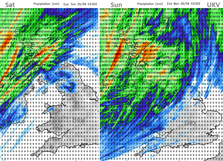
At the weekend the high pressure will be sliding away towards Germany and Atlantic weather fronts will make inroads over the northwestern half of the UK. This leaves much of England and Wales with fine, dry and very warm weather, although more cloud for NW England and north Wales and more sunshine for southeast England on Saturday. Sunday could turn more unsettled with more cloud and hefty downpours as the weekend draws to a close. Northern Ireland, northern and western Britain look most likely to see rain. Ahead of this, the air will become hot and humid with temperatures into the high 20s Celsius, even reaching 30C again.

Northern Ireland – it looks like an unsettled overall picture but with the chance of bonus bright and warm spells. More cloud and outbreaks of showery rain with a light southerly wind. The models vary about how much of an improvement there could be on Saturday afternoon and temperatures could then reach 25C in Belfast.
Wales and NW England look to start the weekend with more cloud and some patchy rain but Saturday brightens and warms with hardly any breeze by Saturday afternoon. Hereford up to 26C and sunny Colchester, 27C. The ECM model seems more keen on a few western showers but overall, the signal is for a lot of fine, sunny warm weather. Sunday could go downhill with a band of heavy showers from the west. It will become blustery with a fresh southerly wind as the cloud cover increases before the rain arrives over Wales. This will then lower the temperatures considerably. There is a similar story for Cumbria, Lancashire across to the Pennines through the second half of Sunday but with some torrential downpours possible. The wind will veer to a blustery westerly.
Frontal bands will move across Scotland on Saturday with heavy rain and blustery winds. Another slower band of rain will move in from the west on Sunday and this could bring torrential, thundery downpours during the day. On Saturday there could be some shelter from the rain for southern and eastern parts of Scotland and it will warm up in the south-westerly flow.
There is some uncertainty about the timing of the band of rain on Sunday across northern Britain but the southerly winds will veer to a westerly by the end of the day and there could be some heavy rain around. This will affect the temperatures. Eastern Scotland could see 26C on Saturday to the lee of high ground.
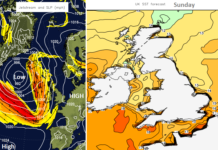
In the heat and sunshine on Saturday, there will be very light winds for England and Wales with sea breezes developing during the day. It’s never going to feel like the Mediterranean but there are warmer than usual waters around our coasts.
“Sea surface temperatures around the UK are above average for the time of year. The current temperatures, as shown below, are more typical for August or September. “MO
For much of Saturday, there will be a lot of fine, dry and sunny weather with high temperatures.

On Sunday there will be a noticeable southerly wind for England but still heat. We will just have to see how the frontal band from the Atlantic develops and when it arrives with the downpours. London could still reach 30C in the sunshine ahead of any change.


